Church Island, Valentia
Early Christian site
This is the third island site we visited on our short trip to Iveragh Peninsula, County Kerry. Church Island is a small, but high island lying in Valentia Harbour. We had made arrangements with local fishermen to takes us to the island. An early christian site was established here in the 7th/8th century.
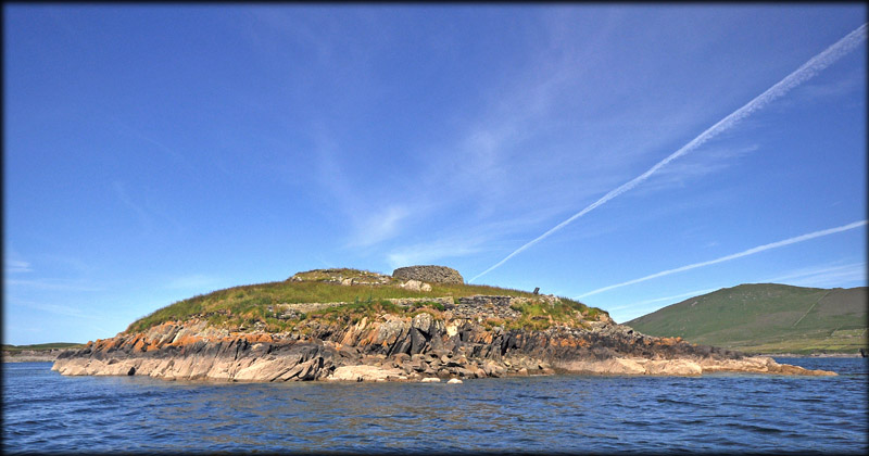
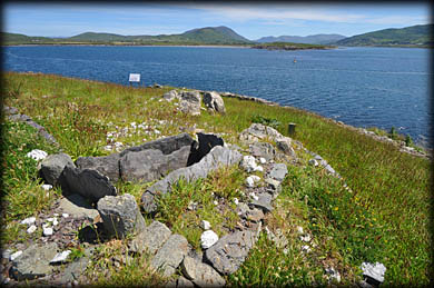
As we approached from the east, we could see a Clochan (Beehive hut) and a large mound sitting on the rocky knoll. The mound is a shrine, comprised of at least ten terraces. Each terrace lined with stone and filled with quartz. As we were ascending the rocky knoll, the rectangular stone oratory built on the west side of the island came into view.
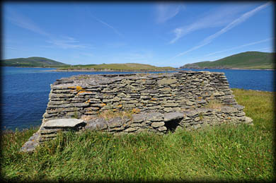 East gable of the oratory
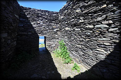 Interior
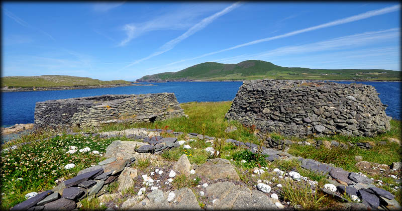
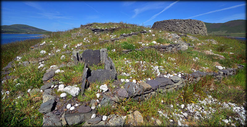
In the image above, you can see the oratory to the left and the clochan to the right, with the apex of the terraced shrine in the foreground. The top terrace (10) was removed during excavations in the 1950s. The terracing is at least 26 metres long from east to west . A large number of burials were found throughout the various levels . It is believed a gable shrine similar to the one on Illaunloughan stood on the top terrace. The stone oratory and clochan were built in the 10th/11th century over the site of earlier structures. These early structures were probably built with timber and sod. The entrance to the oratory is on the west side and is fenced off for safety reasons.
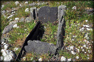
Corner post shrine
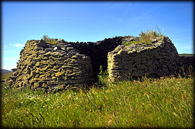
Clochan
A corner-post shrine sits at the south-east end of the fifth terrace, see images above and below. It was built using Valentia slate slabs, with a green conglomerate used for the slotted corners, only two corners remain. At Caherlehillan there is a fine example of a corner post shrine. It believed terraces 8, 9, 10 were built first and the lower levels added sometime later. In total around 48 burials were found in the terraced shrine.
It must have looked quite stunning in the early medieval period, with the white quartz glistening in the sun. You can clearly see some of the terracing in the image above, unfortunately most of the quartz pebbles are hidden in the long grass. An ogham stone, several cross slabs and two stone crosses from the island are now stored on the mainland.
Situated: In Valentia Harbour, about 1.5 kilometres north of Knightstown.
Discovery Map 83: V 4299 7861. Last visit June 2018.
Longitude: 10° 16' 60" W
Latitude: 51° 56' 15" N
Photos: Jim Dempsey.